The Land Rights in Maputo project seeks to support communities of informal settlements in Maputo, Mozambique in formalizing their land ownership through urban planning, urban interventions, capacity building, and advocacy. The project is carried out in collaboration with Architects without Borders – Denmark, the Mozambican NGO Estamos, and the Maputo-based architectural office Bulande Arquitectos. The first phase of the project is currently in the process of implementation in the centrally located informal settlement, Maxaquene D. The project has developed a plan for a part of the neighborhood pending approval of the municipality. Subsequently, the project will assist the local community through the legal process of formalizing the land ownership. The project includes capacity building of local communities in order to raise awareness of their rights as well as advocacy activities seeking to engage the municipality in infrastructural investments and formalization of land ownership in the informal settlements of the city. On the basis of the first phase, the project seeks to develop the methodological tools for scaling up the project activities in subsequent interventions.
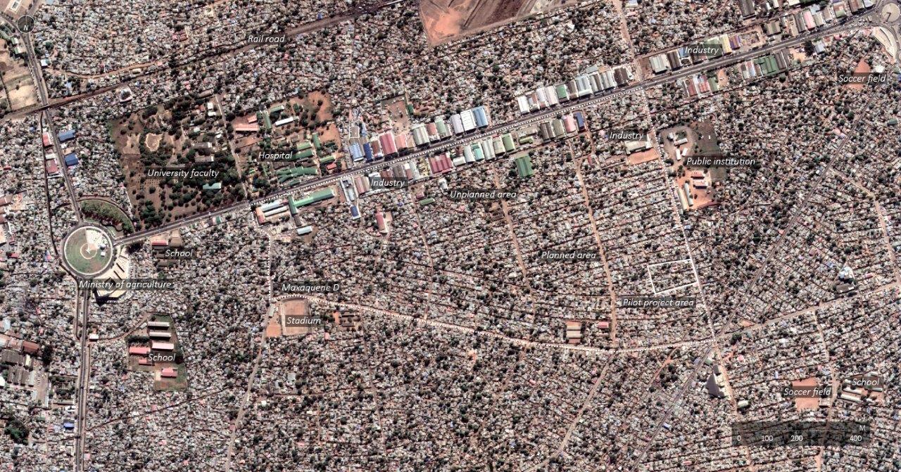
The informal settlement Maxaquene D was selected for the intervention as it is one of the most centrally located informal settlements in Maputo. It is characterized by qualities related to its proximity to the formal city center, having some degree of infrastructure, and being relatively well-connected to the public transportation system. Due to its central location, gentrification of the area within the following decades is likely. Formalization of land ownership would improve the conditions of the residents, when more privileged segments of society seek to acquire the land. Additionally, most of the neighborhood already has a structured plan layout as a result of a structural land readjustment program by UN-Habitat in the 1970s. Accordingly, little restructuring of the urban layout is necessary for complying with the urban regulation, leading to fewer obstacles and higher chances of successfully completing the project. Finally, many informal settlements have planned urban layouts but lack formal land rights. Accordingly, providing the methodological steps for formalizing such areas in a low-cost procedure could pave the way for larger scale formalization processes in the city.
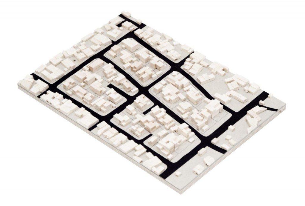
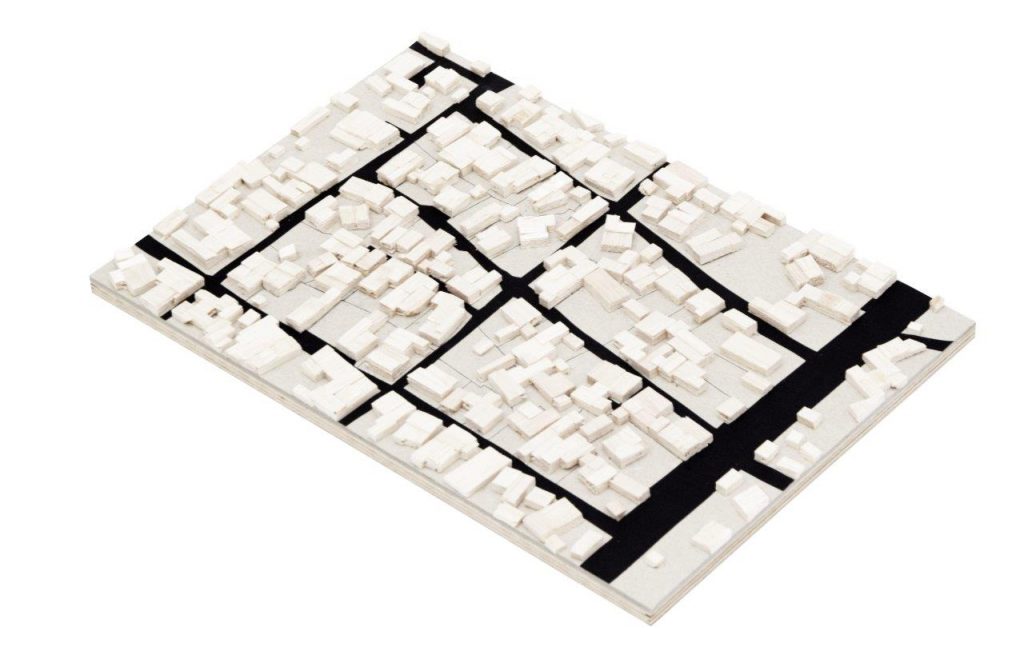
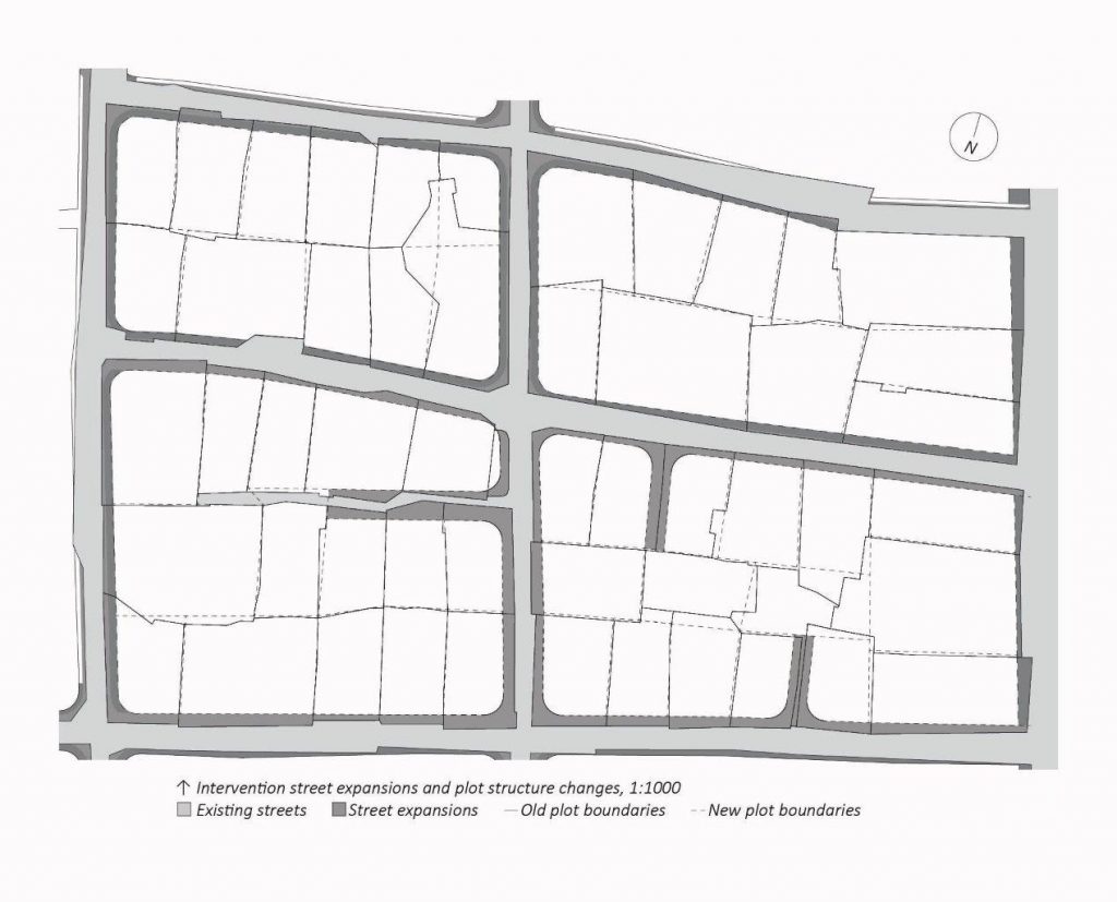
The first phase of the project seeks to formalize the land ownership at the scale of one ‘block’ (quarteirão, the smallest administrative unit), of approximately 500 residents. The formalization process of the first block will serve as a reference for larger scale formalization of the neighborhood in future interventions. The block is located adjacent to a paved street connecting two major roads in the city. The area has a structured layout with rectangular plots of approximately 10x15m, and 2-4m wide streets characterized by some encroachment. While most of the plots have access through this street network, some plots only have access through narrow alleys or by passing through the neighboring plot. In order to acquire formal land rights, there must be an approved urban plan for the area, the plot must comply with the plan, the resident must document having resided on the plot for at least 10 years, and the plot must have access by car. If these conditions are met, the residents can apply for a formal land title.
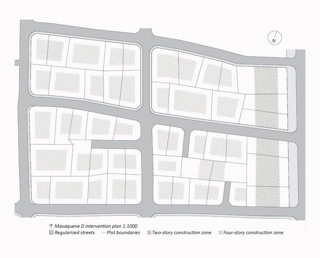
The project has developed a local urban plan for the block in dialogue with the municipality, in order to comply with the concerns of the administration responsible for approving the plan. Concurrently, the plan was discussed with the local community in order to provide an understanding of the requirements for getting the plan approved and the process of formalizing the land ownership. The plan includes expansions of the streets which will require some demolitions of built structures and concessions of land appropriated by the residents through street encroachment. The plan outlines zoning of future construction in the area, with four-story mixed-use row-houses adjacent to the local main street and two-story ‘twin-houses’ and detached houses in the rest of the plan. A plan including more rowhouses and higher densities was developed, but was rejected by the municipal planners, who favoured lower densities and detached housing typologies. The plan was submitted to the municipality and is currently pending approval of public authorities. Subsequently, the project will support the residents through the legal process of attaining formalized land ownership. Thereby the project seeks to eradicate the risk of forced evictions, improve the negotiation position of the residents during future gentrification processes, increase the infrastructure investments, and improve the public hygiene conditions of the neighborhood.